30 springs where nobody charges you to get in the water, sorted by state. Free comes with a few strings, though, and they're worth knowing before you go.
Last checked 19 September 2026 · prices and hours change, so confirm with the operator before you drive
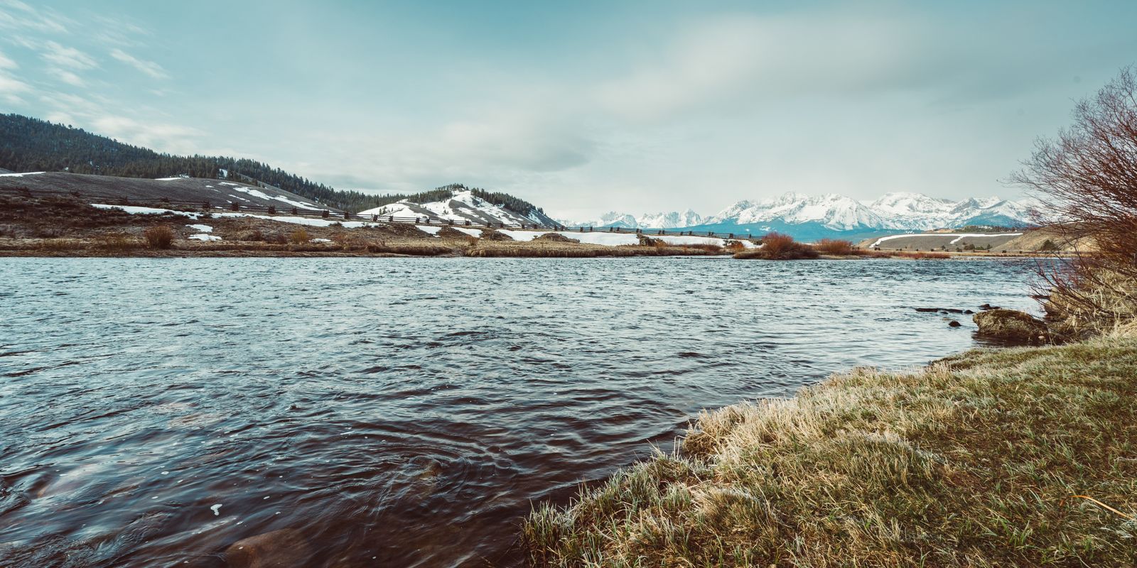
Early spring on the river at Stanley, Idaho, the kind of country where the soaks sit right at the water's edge and nobody hands you a wristband.
Free means free to soak. It doesn't always mean free to park. Forest Service sites often want a Northwest Forest Pass or an America the Beautiful pass on the dashboard, state parks charge at the gate, and a spring on private land may ask for a donation in a box. Where that applies, the fee line on the entry says so.
Free springs are also the ones most likely to close, get gated or pick up new rules from one season to the next, because they're run by agencies managing crowds rather than owners chasing customers. The quickest way to lose one is to trash it. Read the land manager's page (linked under every entry) the week you go, keep the noise down, and pack out everything you brought, plus a little extra if you can.
Blue River (Clifton Ranger District) · Greenlee County, Blue Range Primitive Area
Hike-inhike-in (multi-mile backcountry route on Blue River Trail #101 from the XXX Ranch trailhead at the end of FR 475C; frequent river crossings; roughly 6-7 miles one way)no fee
°F scale 60–120
Waternot published
FeeFree to soak
Seasonyear-round
LandUSFS (Apache-Sitgreaves National Forests, Clifton Ranger District)
WhereBlue River (Clifton Ranger District), Arizona
DriveTucson ≈ 4 h 30, Phoenix ≈ 5 h
Wallow Fire country: the 2011 burn left this stretch prone to falling trees and flooding, and the Forest Service says so up front. Hannah is a remote hot spring on the Blue River in the Blue Range Primitive Area, reached by Blue River Trail #101, which the Forest Service calls more a suggested route than a developed trail, with frequent river crossings. Expect roughly 6 to 7 miles one way from the XXX Ranch trailhead, at the end of about 15 miles of forest road from US 191. Nobody publishes a water temperature. Treat all water and leave no trace.
Bloody Basin / Verde River (north of Carefree) · Yavapai County
Primitivehigh-clearance (about 33 miles of FR 24 then 12 miles of rarely maintained FR 269; 4x4 often needed when wet)no fee
°F scale 60–120
Waternot published
FeeFree to soak
Seasonyear-round
LandUSFS (Tonto National Forest, Cave Creek Ranger District)
WhereBloody Basin / Verde River (north of Carefree), Arizona
DrivePhoenix ≈ 2 h 30, Tucson ≈ 4 h 15
Sheep Bridge sits beside the Verde River 45 miles north of Carefree, at the end of about 33 miles of FR 24 and 12 miles of rarely maintained FR 269; the Forest Service calls it rocky and technical, requires high clearance, and 4x4 is often needed when wet. Roads flood and the river rises and falls. At the end you'll find a small primitive hot spring, a replica historic sheep bridge on the National Register since 1978 (foot and bike only) and the gateway to the Mazatzal Wilderness. No fees, no restrooms, no water, so bring everything. The Forest Service doesn't describe the pool itself.
Childs (near Camp Verde / Strawberry) · Yavapai County
Primitivehigh-clearance (FR 708 then 6 miles of FR 502, described by the USFS as a very bad road) to Childs, then a short hike upstream and a river wadeno fee
°F scale 60–120
Waternot published
FeeFree to soak
Seasonyear-round
LandUSFS (Coconino National Forest, Red Rock Ranger District)
The ruins of Verde Hot Springs, once a famous resort, sit upstream of the free Childs camping area on the Verde River, a short hike and some wading away. Getting to Childs is the hard part, about 30 miles southeast of Camp Verde on FR 708, then six miles of FR 502, which the Forest Service calls a very bad road. High clearance is highly recommended and four-wheel drive may help. River rules mean fire pans only, portable toilets for river overnights, a 14-day stay limit and no garbage service, so pack it all out. Check for fire restrictions before you go; nobody publishes a water temperature.
Hike-inhike-in (about 8.5 miles one way)no feeclothing-optionalreservations required
°F scale 60–120
Waternot published
FeeFree to soak
Seasonsummer
LandUSFS (White River National Forest)
WhereAspen, Colorado
DriveDenver ≈ 3 h 45, Colorado Springs ≈ 4 h 30
This is the backcountry soak Colorado hikers save for: a natural pool high in the Maroon Bells-Snowmass Wilderness, about 8.5 miles up the Conundrum Creek valley from a trailhead near Aspen. Day use is free, which makes for a very long day on foot. Sleeping up there takes a Recreation.gov permit year-round, and you camp only in the site you reserved. Snow buries the trail from roughly October to late June, so aim for July through September, as the Forest Service suggests. Leave the dog at home, pack a bear canister and forget the campfire.
Primitivehike-in (foot trail from Warm Springs Road; no designated access from the recreation site)no feeclothing-optional
°F scale 60–120
Waternot published
FeeFree to soak
Seasonyear-round
LandBLM (Kremmling Field Office) / Colorado Parks and Wildlife (Radium State Wildlife Area)
WhereKremmling, Colorado
DriveDenver ≈ 2 h 30, Colorado Springs ≈ 3 h 30
A free, primitive warm pool on the Upper Colorado River near Kremmling, and getting there the right way matters. The old social trail from the Radium Recreation Area is closed to protect wildlife habitat, there's no designated route from the recreation site, and you can't park along narrow Radium Road. Instead, follow Trough Road (County Road 11) to Warm Springs Road, 1.5 miles northeast, where the foot-only Warm Springs Trail begins. BLM doesn't describe the pool's temperature or condition, so keep expectations modest. The BLM campground closes Dec 1 to Mar 31; otherwise single sites are $6 a night.
Elk Bend (south of Salmon) · Salmon River corridor, US 93
Hike-inhike-in (the first quarter mile crosses private land on a public easement)no fee
°F scale 60–120
Waternot published
FeeFree to soak
Seasoncheck with the BLM
LandBLM (Salmon Field Office) trailhead; springs lie on the Salmon-Challis National Forest
WhereElk Bend (south of Salmon), Idaho
DriveMissoula ≈ 2 h 45, Boise ≈ 4 h 45
A free hike-in soak south of Salmon, with the trailhead on BLM land and the springs themselves on the Salmon-Challis National Forest. Head 23 miles south of Salmon on Highway 93, turn east just past Elk Bend, and drive 0.3 miles on the county road. The first quarter mile of trail crosses private land on a public easement: keep dogs leashed there, stay on the path, and be a good guest, because courtesy is what keeps that access open. Nobody publishes the trail length, the number of pools or a water temperature, so bring water and decent shoes and give yourself plenty of daylight.
Gerlach · Humboldt County (Black Rock Desert–High Rock Canyon NCA)
Primitivehigh-clearance (playa crossing; impassable when wet)no fee
°F scale 60–120
Waternot published
FeeFree to soak
Seasondry-playa season only
LandBLM (Black Rock Field Office)
WhereGerlach, Nevada
DriveReno ≈ 2 h 45
First, the water: the smaller, deeper pool is too hot to enter, and the larger shallow one is hot too, so treat this as a place to camp and look rather than a soak. It sits at the foot of the black rock landmark on the north edge of the playa, a stop on the Applegate emigrant trail, in about as dramatic a desert setting as Nevada offers. Getting there means crossing the playa, which must be bone dry; wet, it's impassable. Call Friends of Black Rock-High Rock on 775-625-7848 for conditions, and camp well back from the springs.
Gerlach · Humboldt County (Black Rock Desert–High Rock Canyon NCA)
Primitivehigh-clearance (playa and dirt roads; impassable when wet)no fee
180–185 °F · body temp marked
Water180–185 °F
FeeFree to soak
Seasondry-road season only
LandBLM (Black Rock Field Office)
WhereGerlach, Nevada
DriveReno ≈ 3 h
Look, don't touch. These deep, bubbling pools run at about 180 degrees, too hot to touch and dangerous to people and pets, which is why they're fenced and signed. Keep dogs leashed and well back. The reason to come is history, since these pools north of Black Rock Point look much as they did to emigrants bound for Oregon and California. Getting here means playa and dirt roads that are impassable when wet, so you'll want high clearance and a dry spell. Pair it with Black Rock Point on the same trip.
Primitivedrive-up (about 20 minutes from Dyer on a county-maintained dirt road)no fee
105 °F · body temp marked
Water105 °F
FeeFree to soak
Seasonyear-round
LandEsmeralda County
WhereDyer, Nevada
DriveLas Vegas ≈ 4 h 15, Reno ≈ 4 h 45
A big concrete tub sunk into the ground beneath the White Mountains and Boundary Peak, fed by a strong flow of water at about 105 degrees. The overflow runs into marshy ponds full of goldfish, and those ponds are also home to the endangered Fish Lake Valley tui chub, so leave them be. It's free, open all year, run by Esmeralda County, and about 20 minutes from Dyer on a county-maintained dirt road. There's a large parking area, primitive campsites and a vault toilet. Pitch your tent well away from the water, since camping within 100 feet of the spring is discouraged.
Gerlach · Humboldt County (Black Rock Desert–High Rock Canyon NCA)
Primitivehigh-clearance (about 60 miles of dirt road north of Gerlach; 4WD recommended)no fee
°F scale 60–120
Waternot published
FeeFree to soak
Seasonyear-round, weather permitting
LandBLM (Black Rock Field Office)
WhereGerlach, Nevada
DriveReno ≈ 4 h
Sixty miles of dirt road north of Gerlach lead to a spread of hot and cold springs that are the only home of the desert dace, a threatened minnow. The area is protected for the fish and its cultural sites, and restoration work is improving their habitat while still allowing soaking, so tread lightly in and around the water. The BLM keeps a designated campground with accessible tent pads and a small public cabin, both first-come and free. Bring a high-clearance four-wheel-drive, skip the trip after rain when the roads turn impassable, and check the camping restrictions before you go.
Primitivedrive-up (graded dirt road off NV 376)no fee
100–130 °F · body temp marked
Water100–130 °F
FeeFree to soak
Seasonyear-round
LandBLM (Battle Mountain District, Tonopah Field Office per BLM blog)
WhereAustin, Nevada
DriveReno ≈ 3 h 18
Classic Nevada: two metal cattle troughs, the so-called cowboy tubs, plus a soft-bottomed pool, out on public land southeast of Austin in the Big Smoky Valley. Pipes carry source water at around 130 degrees, and soakers divert the flow to set the temperature, so test with a hand before you climb in. It's free and reached by a graded dirt road off NV 376. There are no toilets, no drinking water and no services of any kind. Bring everything you need and carry everything out; the BLM runs volunteer cleanups here for a reason.
Gerlach · Washoe/Pershing County (Black Rock Desert–High Rock Canyon NCA)
Primitivehigh-clearance (about 20 miles northeast of Gerlach along the railroad grade)no fee
°F scale 60–120
Waternot published
FeeFree to soak
Seasonyear-round
LandBLM (Black Rock Field Office)
WhereGerlach, Nevada
DriveReno ≈ 2 h 30
Do not get in. In June 2020 the BLM found E. coli, fecal coliforms and Vibrio cholerae in the water here and advised against bathing or any contact at all, and the state tourism agency repeats that advice. Trego is a long ditch-fed hot spring on the east side of the Black Rock playa near the Trego railroad siding, about 20 miles northeast of Gerlach along the railroad grade. It's listed so you know to drive past. If you came to the Black Rock to soak, Soldier Meadows to the north is where soaking is still allowed.
Denio · Humboldt County (Sheldon National Wildlife Refuge)
Primitivedrive-up (Virgin Valley Road off NV 140, 1.5 miles from refuge headquarters)no fee
°F scale 60–120
Waternot published
FeeFree to soak
Seasonyear-round
LandUSFWS (Sheldon National Wildlife Refuge)
WhereDenio, Nevada
DriveReno ≈ 4 h 15
Way up in the remote Sheldon National Wildlife Refuge near the Oregon line, in a valley known for opal mining, the refuge campground pipes warm spring water into a pool. There's drinking water, pit toilets and a rustic shower house, which counts as comfort out here. It's free, first-come first-served, open all year, and you can stay up to 14 days in any 30. Turn onto Virgin Valley Road off NV 140; the campground is 1.5 miles from refuge headquarters. They don't publish a water temperature, and it's billed as warm, so think bath rather than hot tub.
Primitiveshort walk (from the road on the west side of the John Dunn Bridge)no fee
°F scale 60–120
Waternot published
FeeFree to soak
Seasonyear-round
LandBLM (Rio Grande del Norte National Monument, Taos Field Office)
WhereArroyo Hondo, New Mexico
DriveSanta Fe ≈ 1 h 54, Albuquerque ≈ 3 h
Black Rock is a set of primitive pools right at the edge of the Rio Grande below the John Dunn Bridge, on BLM land in Rio Grande del Norte National Monument and a short walk from the road on the west side of the bridge. The pools rise and fall with the river, so their state on any given day depends on the water level. The BLM closed the area during the bridge work through March 19, 2023, and the access road has a history of closures. Call the Taos Field Office (575-758-8851) before you drive out. There's no fee, and they don't publish a temperature.
Hike-inhike-in (about 7 miles via Little Bear Canyon Trail 729, or a little over 8 miles via the Middle Fork; many river crossings)no fee
94 °F · body temp marked
Water94 °F
FeeFree to soak
Seasonyear-round
LandUSFS (Gila National Forest, Gila Wilderness)
WhereGila Hot Springs, New Mexico
DriveAlbuquerque ≈ 4 h 30, Santa Fe ≈ 5 h
Keep your head above water here: the Gila springs carry a Naegleria fowleri warning. Jordan is the Gila Wilderness soak for people who like to earn it, a pool about twenty feet across and three feet deep at about 94 F. It's about seven miles in via Little Bear Canyon (Trail 729), or a little over eight up the Middle Fork, with many river crossings that turn hazardous at high water. The NPS suggests making it an overnight trip. Firewood is scarce because so many people come, so carry a stove and leave no trace.
Hike-inhike-in (about 0.75 mile from the Gila Visitor Center on Middle Fork Trail 157; river crossings)no fee
130 °F · body temp marked
Water130 °F
FeeFree to soak
Seasonyear-round
LandUSFS (Gila National Forest, Gila Wilderness)
WhereGila Hot Springs, New Mexico
DriveAlbuquerque ≈ 4 h 30, Santa Fe ≈ 5 h
The easy wilderness soak in the Gila: about three-quarters of a mile, roughly 20 minutes, up Middle Fork Trail 157 from the Gila Visitor Center. Don't put your face under; the NPS warns of Naegleria fowleri. The spring comes out of the base of a hill at about 130 F and pulses roughly once a minute, so you soak in rock-lined pools built in the river, where it mixes with the cold water. The trail crosses the river, and those crossings can be hazardous at high water. Pair it with the cliff dwellings for a full day.
Hike-inhike-in from the John Dunn Bridge trail or by river float; Tune Drive access is closedno fee
°F scale 60–120
Waternot published
FeeFree to soak
Seasonyear-round
LandBLM (Rio Grande del Norte National Monument, Taos Field Office)
WhereArroyo Hondo / El Prado, New Mexico
DriveSanta Fe ≈ 1 h 54, Albuquerque ≈ 3 h
The ruins of an old bathhouse and stagecoach stop sit beside these rock pools on the east bank of the Rio Grande, which is half the reason to come. Getting there legally takes some care. The BLM says the only access is by river float or on foot from the John Dunn Bridge trail, and the scenic easement off Tune Road is closed to the public, so ignore any old directions that send you down Tune Drive. The pools depend on the river level, the area was closed during the 2022-23 bridge work, and the BLM gives no temperature. Check with the Taos Field Office before you go.
Hike-inhike-in (about 1.8 miles one way via East Fork Trail #137 from Battleship Rock)no fee
°F scale 60–120
Waternot published
FeeFree to soak
Seasonyear-round
LandUSFS (Santa Fe National Forest, Jemez Ranger District)
WhereJemez Springs, New Mexico
DriveSanta Fe ≈ 1 h 24, Albuquerque ≈ 1 h 30
A forest walk to a spring the Forest Service itself names 'warm', which is fair notice for anyone hoping for a hot tub. Park at the Battleship Rock Trailhead off NM 4, about five miles north of Jemez Springs, and follow East Fork Trail #137 roughly 1.8 miles each way. There's no potable water, so carry your own, and expect snow on the trail in winter. The Forest Service doesn't publish a temperature, a pool description or a fee, so set out for the walk and count the soak as a bonus.
Landprivate (United World College-USA, leased to Friends of the Montezuma Hot Springs)
WhereMontezuma (Las Vegas), New Mexico
DriveSanta Fe ≈ 1 h 15, Albuquerque ≈ 2 h 15
Concrete and rock pools right beside NM 65 near Las Vegas, on land owned by the United World College and looked after by the Friends of the Montezuma Hot Springs, a community nonprofit. It's free and open 6am to 10pm daily; stay past 10 and you're trespassing. The house rules are short and firm, banning nude bathing, drugs, alcohol, smoking, vaping and glass. The Friends don't run a website, so the posted rules are what you go by. Leave something in the donation box on site for the people who keep it open.
Primitivehigh-clearance (5 miles of Forest Road 376) then 0.7-mile out-and-back trail; about 5 extra miles on foot when FR 376 is gatedno fee
°F scale 60–120
Waternot published
FeeFree to soak
Seasonyear-round on foot
LandUSFS (Santa Fe National Forest, Jemez Ranger District)
WhereLa Cueva / Jemez Springs, New Mexico
DriveSanta Fe ≈ 1 h 45, Albuquerque ≈ 1 h 45
Hot water seeps out of a steep hillside and fills several rock-lined pools, each a different temperature, in the Santa Fe National Forest. When the road is open you drive 5 miles up Forest Road 376 from NM 126 (high clearance) and walk 0.7 mile. When it's gated, you walk or cycle in and add about 5 miles each way. It closes to vehicles every winter (from Jan 2, 2026), and in 2025 it also closed Mar 3 to Jul 1 for breeding wildlife. Check the forest's closure notices before you set off, and bring a bike if the gate might be down.
LandUSFS (Santa Fe National Forest, Jemez Ranger District)
WhereJemez Springs, New Mexico
DriveSanta Fe ≈ 1 h 30, Albuquerque ≈ 1 h 30
Keep water out of your nose at Spence: the water quality isn't monitored and the Forest Service warns of Naegleria fowleri. Nudity is cited here as a violation of state law. That said, it's an easy outing, a short walk from a seven-space paved lot five miles north of the Jemez Ranger District office, with no sign for the spring. Temper your expectations on heat. It was about 95 F and has been cooling for several years, so it's now roughly body temperature. No glass, camping or campfires, and dogs stay leashed. With seven spaces, early is better.
Primitivedrive-up (gravel Hot Springs Road from refuge headquarters; open until weather closes it)no fee
°F scale 60–120
Waternot published
FeeFree to soak
Seasonyear-round subject to weather and road conditions
LandUSFWS (National Wildlife Refuge)
WherePlush, Oregon
DriveBend ≈ 3 h 30, Portland ≈ 6 h 30
This is a soak in antelope country: a natural hot spring inside the Hot Springs Campground on the Hart Mountain National Antelope Refuge, at the eastern base of Warner Peak. It's free, and so is the first-come camping. The refuge doesn't describe the pool or publish a water temperature, so arrive curious. After the 2024 Warner Peak Fire, new campsites went in behind buck-and-rail fencing to let the streamside recover; please keep to them. There are vault toilets and no water, so bring everything you'll drink. Trailers over 24 feet won't fit, and weather can close the road.
Adrian (Owyhee Canyon) · Lower Owyhee River, BLM Vale District
Primitivedrive-upno fee
190 °F · body temp marked
Water190 °F
FeeFree to soak
Seasonyear-round day use
LandBLM
WhereAdrian (Owyhee Canyon), Oregon
DriveBend ≈ 5 h, Portland ≈ 7 h
The water here leaves the bank at 190 degrees, so test any pool with your hand before you sit. Along the Lower Owyhee River, soakers have piled river rocks into pools that mix that scalding source with river flow, and in spring runoff the river can swallow the pools entirely. It's free BLM land, open for day use from sunrise to sunset, and the no-camping rule is strictly enforced, as is the fire ban. There's a vault toilet and parking. Head out from Adrian on Owyhee Lake Road and make it a canyon afternoon.
Primitivehigh-clearance recommended (graded and dirt desert roads)no fee
°F scale 60–120
Waternot published
FeeFree to soak
Seasonyear-round
LandBLM (Fillmore Field Office area)
WhereDelta, Utah
DriveSalt Lake City ≈ 2 h 45
Way out in the Millard County desert, about 30 miles northwest of Delta, a run of built soaking pools catches water from the Crater Bench geothermal system. The source comes up as hot as about 190 F, so soakers mix hot and cool water in the pools; test before you get in. There's no fee and there are no facilities or services. The roads are graded and dirt, and a high-clearance vehicle is the sensible choice, especially after weather. Bring water, shade and anything you'll need, and enjoy a desert soak beside Fumarole Butte.
Primitivedrive-up (last miles dirt, passable to all vehicles in dry weather)no fee
81 °F · body temp marked
Water81 °F
FeeFree to soak
Seasonyear-round
LandBLM (surroundings, per UGS); Utah State Trust Lands to the west
WhereGandy, Utah
DriveSalt Lake City ≈ 3 h 45
Gandy is a swim more than a hot soak: nearly 9,000 gallons a minute of water at up to 81 F tumbles through small waterfalls, a built cobble pool and a cave, half a mile from the Nevada line. Locals come to soak and swim, and the springs are home to a springsnail found nowhere else, so tread lightly. Entry costs nothing, with camping on the surrounding BLM land. There are no facilities, and the nearest services are at the Border Inn about 30 miles south, so fill the tank first. The last miles are dirt, fine for any car when dry.
Primitiveshort walk (gravel road, park before the wet ground)no fee
100 °F · body temp marked
Water100 °F
FeeFree to soak
Seasonyear-round
Landprivate
WhereMeadow, Utah
DriveSalt Lake City ≈ 2 h 30, St. George ≈ 2 h 30
Three deep, clear pools on private ranch land west of Meadow, open to the public only because the owner allows it. The water sits around 100 F and is quite deep, and the county asks visitors to bring life jackets; take that seriously if anyone in your party swims weakly. Treat the owner's goodwill with care. Don't camp, wear proper attire, and park before the wet ground near the pools instead of driving onto it. It's free, with donations welcome for upkeep. The county suggests March to November as the best season to go.
Primitiveshort walk (about 1/4 mile south of Inlet Park trailhead)no fee
°F scale 60–120
Waternot published
FeeFree to soak
Seasonyear-round
Landmunicipal trailhead (City of Saratoga Springs); springs lie outside city limits on the Utah Lake shore
WhereSaratoga Springs, Utah
DriveSalt Lake City ≈ 45 min
Muddy natural hot pools on the northwest shore of Utah Lake, free and close to town. Start at Inlet Park in Saratoga Springs and follow the Saratoga Hot Springs Trail about a quarter mile south; the springs themselves sit just outside city limits. Nobody publishes a water temperature, and the pools are muddy, so bring an old swimsuit and a towel you don't love. Park rules apply at the trailhead, with hours of 6 a.m. to 10 p.m., no overnight parking, no alcohol, and dogs on a leash. Inlet Park also links to the Jordan River Parkway if you want a walk after.
DriveJackson ≈ 3 h 15, Denver ≈ 6 h 15, Colorado Springs ≈ 7 h 15
Wyoming gives this one away. The State Bath House in Hot Springs State Park is free, with an indoor and an outdoor pool of Big Spring water held at 104 degrees. Summer hours are 8 a.m. to 7 p.m. Monday to Saturday and noon to 7 p.m. Sunday; in winter it closes at 5:30 p.m. The outdoor pool closed on August 24, 2026 for about a month of ADA work, so check it's back before you count on it. Make a day of the park while you're here, since the terraces, a suspension footbridge and a bison herd are all inside it.
Flagg Ranch · John D. Rockefeller Jr. Memorial Parkway
Primitivehike-in (about 0.5 mile from the Flagg Ranch area; creek ford required)no fee
°F scale 60–120
Waternot published
FeeFree to soak
Seasonyear-round in principle
LandNPS (Grand Teton National Park / John D. Rockefeller Jr. Memorial Parkway)
WhereFlagg Ranch, Wyoming
DriveJackson ≈ 1 h 15, Denver ≈ 9 h, Colorado Springs ≈ 10 h
Read the warnings first. Naegleria fowleri, the brain-eating amoeba, has been found in Huckleberry Hot Springs and in Polecat Creek, so keep your head out of the water. The springs themselves are closed to soaking; only Polecat Creek, a mixed stream warmed by their runoff, is legal. Spring water in the area reaches 160°F and thermal crusts can be thin, so stay on solid ground. The walk is about half a mile from Flagg Ranch with a creek ford, and it's snowbound in winter. The Park Service doesn't post current trail conditions online, so ask a ranger before you set out.
Saratoga's town pool costs nothing and never closes: it's free and open 24 hours a day all year, on the west bank of the North Platte behind the municipal swimming pool at the east end of Walnut Street. The main pool runs from about 106 degrees at its coolest to 119 at the hot end, which is hot enough to scald, so test the water before you settle in or use the Not-So-Hot Pool next door, around 100. Swimsuits are required, and alcohol, tobacco, glass and open containers are banned. There's a bath house with showers and restrooms.